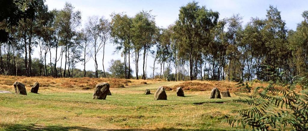
Arbor Low
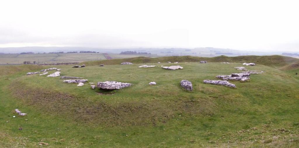
One of the most historically significant monuments in the North and the most important prehistoric site in the East Midlands. You can find this Neolithic Henge high up on the wild Middleton Moor, yet not far from the village of Parsley Hay and the High Peak Trail.
Arbor Low is huge, set within an earthen bank and ditch, a circle of some 50 white limestone slabs, all now fallen, surrounds a central stone ‘cove’ – a feature found only in major sacred sites. This 'cove' consisted of at least six stones and those that believe it to have formed a horseshoe shape suggest that the open end would have faced a midsummer moon setting to the south-southwest. Coves are very rare at British prehistoric sites with only three other examples in England - at Stanton Drew, Avebury and Castlerigg. There have been many finds from Arbor Low which has been subject to several excavations over the last 150 years and possibly earlier, these include cremation remains as well as many flint, bone and antler tools and pots.
Address: Long Rake, Monyash, Bakewell, Derbyshire, DE45 1JS.
Parking: There is a small car parking area on the track up to Upper Oldhams Farm.
Access: It is a 300-metre walk from the parking area to the stone circle through fields with gates or stiles, which can be challenging, particularly for wheelchairs or buggies. Be aware that access is through a working farmyard and private landholdings, for which the landowner issues a £1 charge per person.
Facilities: There are no facilities on site. The nearest public toilets and a café are at Parsley Hay, just over a mile away to the west near the A515 junction with The Rake or head over to the Royal Oak at Hurdlow, where you will find great food, local ales and a warm welcome!
Dogs: Dogs on leads are welcome but must be kept under close control as there may be animals grazing.
Peak Venues property: The Telephone Exchange
Barbrook I
Access: There is a large lay-by on the A621 where you can park and walk over or alternatively head to Curbar Village and use the National Trust Car Park at Curbar Gap. From here you can head out onto Big Moor.
OS Map Grid Ref: SK 28624 75466
Peak Venues Property: Edge Cottage
Doll Tor
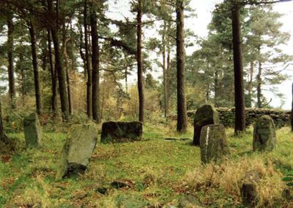
Sometimes referred to as Six Stones this small stone circle is near the village of Birchover, west of Stanton Moor. Dating from the Bronze Age, the circle consists of six standing stones. The site was excavated in 1852 by Thomas Bateman, and again from 1931 to 1933 by J. P. Heathcote. During this second excavation, three stones were smashed and later repaired with cement. In 1993, unknown visitors rearranged the stones to create a more complete but historically inaccurate circle. It was later restored by English Heritage and Peak District National Park Authority to something close to its original Bronze Age appearance. Doll Tor stone circle is a Scheduled Ancient Monument.
Car Parking & Access: The nearest village to Doll Tor is Birchover where you can park to start your walk.
Facilities & Refreshments: Birchover also has a couple of great pubs for food and refreshments
Peak Venues Property: Red Lion Yard
Hordron Edge
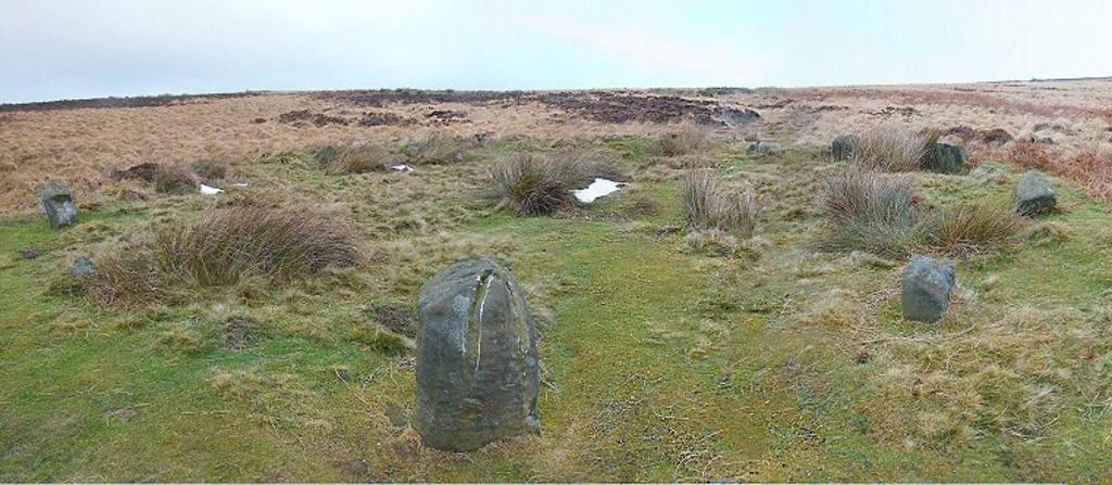
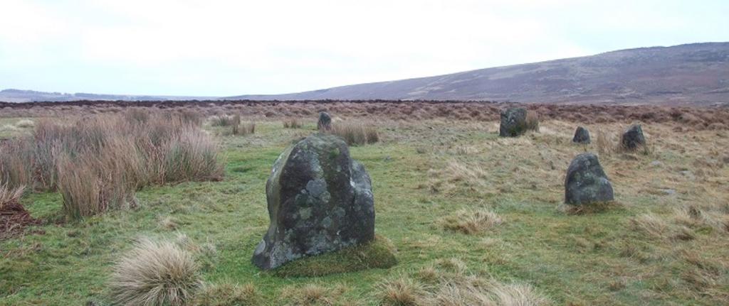
The Seven Stones of Hordron (which sounds like it should be in Middle Earth) can be found in the Hope Valley close to the village of Bamford and Ladybower Reservoir. Sitting on the shelf of land known as Moscar Moor with Stanage Edge to the east, the carved rock of Ladybower Tor to the west and the the stone circle and cairns of Bamford Moor a mile to the south. Although it is also known as the 'Seven Stones of Hordron' there are in fact 11 stones here plus another three that were discovered below the peat during investigations in 1992 - gaps between the stones would suggest that there were originally several more. Unlike many Derbyshire circles the stones are not set into a bank but instead form a freestanding ring of between 15-16 metres with heights ranging from about half a metre to the largest one metre tall stone to the southwest. This stone (known as the Fairy Stone) could provide an intriguing insight into the Bronze Age builders world view. The top of the stone bears a curious similarity in shape and angle to two distant hills also to the southwest - Win Hill two miles away and Lose Hill, four miles away. This apparent mirroring of distant landscape features by a prominent circle stone is also seen at Wet Withens a few miles to the south where the hill mirrored is Higger Tor (over which the midsummer sun is seen to rise).
Whether these alignments were deliberate or just coincidental there is no dispute that there are some impressive views from Hordron Edge to the southwest across the flooded valleys of the Rivers Derwent and Ashop which now form Ladybower reservoir.
Car Parking: Park up at Cutthroat Bridge Car Park on the A57
Facilities and Refreshments: Public toilets are available at Ladybower Reservoir and head to Bamford or Hathersage for some great pubs, cafe's and restaurants.
Nine Ladies
In common with many other stone circles, little evidence has been uncovered to suggest why or when this stone circle was built and how it was used. Suggestions include a place for ceremony or burial, a territorial marker, a perceived link between the earth and the sky and the living and the dead, or a meeting place for seasonal events. Such monuments may have had many functions, their uses and perceived significance shifting over time.
Parking: There is no car park for the site but there is a small stretch of Lees Road 300 metres from Stanton in Peak near the easiest footpath to the stone circle where it is possible to park in an informal lay-by just off the road on the right hand side. Alternatively start your route from Birchover Village
Access: The site can be accessed via a number of footpaths depending upon your start point. The most straightforward one involves a 700-metre walk from the parking place described above to the stone circle. It passes through fields and woodland with gates, stiles and uneven surfaces, which can be challenging, particularly for wheelchair users or buggies.
Facilities: There are no facilities on site, the nearest village is Birchover which has a couple good pubs for food and refreshments
Dogs: Dogs on leads are welcome but must be kept under close control as there may be animals grazing.
OS Map Reference: SK 24936 63042
Nine Stones Close
No longer nine, but four stones remain of this stone circle that is also known as 'the grey ladies'. These are the largest stones in Derbyshire, they stand isolated in a farmers field on Harthill Moor, almost due west of Doll Tor and the ritual complex of Stanton Moor that lies a short distance beyond.
In the middle of the 19th century, the antiquarian Thomas Bateman recorded seven upright stones at the site as well as finds of pottery shards and flints. A little further south is the rock outcrop of Robin Hood's Stride which may have served as a sacred hill alter, as from the centre of the circle the major southern moon is seen to set between the two stone pillars on top of the hill. There are several legends and myths attached to this circle, one claims that the stones dance at midday, another says they dance at midnight. A story recorded in the 19th century tells of a farm labourer who found a clay pipe at the stones, and when he smoked it, was able to see through the surface of the earth near one of the stones to a land inhabited by fairy folk!
Parking: There is no car park for the site but there is a small stretch of Lees Road 300 metres from Stanton in Peak near the easiest footpath to the stone circle where it is possible to park in an informal lay-by just off the road on the right hand side. Alternatively start your route from Birchover Village
Access: The site can be accessed via a number of footpaths depending upon your start point. The most straightforward one involves a 700-metre walk from the parking place described above to the stone circle. It passes through fields and woodland with gates, stiles and uneven surfaces, which can be challenging, particularly for wheelchair users or buggies.
Facilities: There are no facilities on site, the nearest village is Birchover which has a couple good pubs for food and refreshments
Dogs: Dogs on leads are welcome but must be kept under close control as there may be animals grazing
OS Map Reference: SK22536256
- Special thanks to Chris Collyer of stone-circles.org.uk for kindly allowing us to use some of his photos and information for this post.
- Main image, image 2 and image 6 by English Heritage
Published on November 14, 2019 in
